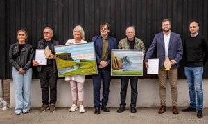
Herálvur Joensen,
aðalstjóri í Oljumálaráðnum
Despite this being a conference on deepwater opportunities, challenges and technology it must be said at the outset that the main challenge of petroleum exploration in the Faroe Islands is not one of bathymetry but one of geology. Geology and proximity to the West of Shetland oil fields have dictated the location of the first exploration wells on Faroese territory. In opposition to many other coastal states the future of Faroese petroleum exploration is not to get into ever-deeper waters, but rather to find a solution to exploring the geologically challenging part of the Faroe Shelf. In other words the main challenge is a gradual transfer of activity from the existing licenses in the southeast to the shallower and basalt covered parts of the Faroe Platform itself.
Results from the first 2 years of exploration
Two years have passed since the first Faroese licenses were awarded and a major part of the commitments has been performed already, notably 3 of the 8 firm wells were drilled in 2001. This year no well has been drilled in Faroese territory, but next year Agip will drill its commitment well, and other operators are planning to drill in 2004.
Looking at the results from the 3 exploration wells, it may be appropriate to take a glance at the point of departure, when the licenses were awarded in the summer of 2000.
The reason that these wells could be drilled in 2001 was that the targets were relatively clearly identified, based on existing data, and that additional seismic data was considered unlikely to make any big difference in the decision process.
In other words, the only real way forward was to drill these prospects.
The main point of departure was quite naturally the experience from West of Shetland, where oil in large quantities has been discovered in certain geological formations, notably Paleocene sections. One of the experiences the industry has made West of Shetland is to identify certain seismic responses and characteristica connected to these hydrocarbon accumulations.
Utilising this experience was very natural and perhaps the only thinkable way of planning the first phase of exploration drilling in the Faroese area. But it was soon to become clear that although geology does not stop at international boundaries, stepping across the Faroe-Shetland Channel is a step into the partially unknown.
Broadly speaking, the first well encountered only traces of hydrocarbons; the second well demonstrated the presence of both oil and gas, although in non-commercial quantities in that particular location, whereas the third well drilled by Amerada Hess on the Marjun prospect contained significant volumes of hydrocarbons, both light oil and gas.
In a more detailed view, the results have demonstrated that none of the main targets turned out the way it was predicted. Clearly, the promising seismic signatures proved to be related to other geological factors than hydrocarbon accumulations, and it was only after drilling deeper into the geological section than originally planned that oil and gas was discovered.
Implications for the future
Concluding from only 3 wells is dangerous but at least the 3 wells have provided large volumes of new and useful information, which will have to be investigated in detail in order to increase the understanding of the geology and hydrocarbon potential. And some lessons have been learned.
For instance that relying too heavily on analogies from West of Shetland has its pitfalls. There is a need to approach exploration in the Faroes with an open mind in order not to preclude opportunities from ever being discovered, and this also implies that there is a need to look both shallow and deep. West of Shetland will remain a valuable experience for exploration in the Faroes but this experience must be applied properly, because the Faroe Shelf is not just a mere extension of the West of Shetland area.
One critical element when enhancing the geological understanding of a new area is the question of openness and data exchange. To a certain degree this also has happened in the Faroese region. The Faroese authorities appreciate that companies have to safeguard their competitive position but have on a number of occasions stressed the importance of sharing as much knowledge as possible. It is our firm belief that in the long run everyone will benefit from sharing data and knowledge as it optimises the chances of future success.
Future opportunities
The Faroe Platform
When speaking of future opportunities in the Faroese region it has been stated several times already that such opportunities are partially dependent upon exploration taking place on the Faroe Platform itself. Already with existing speculative seismic data major structures can be imaged beneath the basalts in certain parts of the Faroe Shelf. Hopefully, the work performed within the 9-year licenses and the SINDRI project can assist in maturing these structures into well-defined and de-risked prospects. The major part of the Faroe Shelf is covered with volcanic material and it is of paramount importance for Faroese authorities that the potential beneath the basalt is vigorously pursued.
The Faroe Bank Channel
When the area on offer in the first licensing round was selected, oil companies nominated blocks to be included. The nomination took place in 1996 and a few oil companies showed interest in the Faroe Bank Channel area. Although that interest seems to be much more moderate now, the Faroe Bank Channel area remains a possible candidate for future rounds.
The northern part of the Faroe-Shetland Channel
The oil industry also nominated blocks further north than those included in the area on offer in the first licensing round. In addition to blocks adjacent to existing licenses the blocks northwards of the area on offer in the first round still appears to be attractive to the industry.
The Hatton-Rockall area
In the longer term some deep water areas to the southwest are likely candidates for future Faroese licensing rounds. This is to some extent dependent upon the outcome of the overlapping claims to the Hatton-Rockall Plateau, where UK, Ireland, Iceland and the Faroe Islands all have designated large areas beyond the normal 200 nm limit. The claims are legally justified in article 76 of the United Nations Convention on the Law of the Sea and will eventually be examined by the Commission on the Limits of the Continental Shelf, which has been established under the Convention.
Water depths on the slopes of the Rockall Plateau approaches 3000 metres.